
_JPEG.jpeg)


Juneteenth Anniversary
- wefithealthwellnes

- Jun 19, 2024
- 14 min read
Updated: Jul 10, 2024
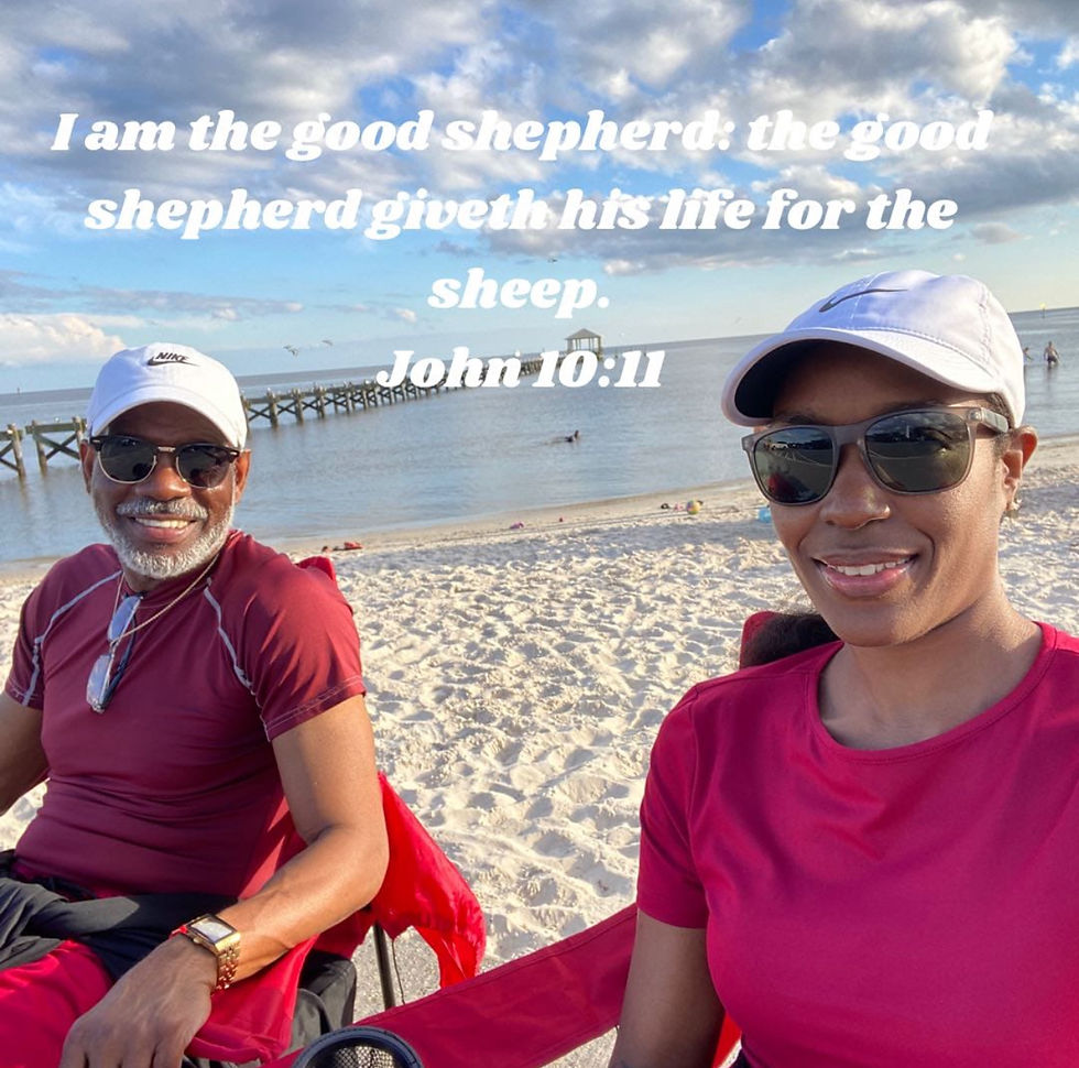
Kenneth & Kenyatta
River Walks
Levee Saunters
Board Promenades, Lake pontchartrain River &
Mississippi Excursions
2021(Then) & 2024(Now)
Alongside the Mississippi River & Lake Pontchartrain River.
Born Down South
Down By The Bayou
(Bayou Babies)
Water & Blood Baptized By The Blood Of The Lamb!
From the Pit ~ To the Palace
~To Now Speaking To The Masses
To A Seat At the Table
Our River History
Happy Juneteenth Anniversary
Juneteenth is an often overlooked event in our nation's history. On June 19, 1865, Union troops freed enslaved African Americans in Galveston Bay and across Texas some two and a half years after President Abraham Lincoln signed the Emancipation dating to 1865, Juneteenth commemorates the day when 250,000 slaves in the state of Texas, which became the last bastion for slavery during the final days of the Civil War, were declared free by the U.S. Army.
From Running Away~ To The White House
Where We Now Stay!!!
Escapes from slavery, and the extreme measures taken to stop these escapes, refuted the propaganda stating that African Americans were simple-minded and needed the civilizing and Christianizing influences of the slave system. The origin of the term “Underground Railroad” is not known precisely, but it was in use by the 1830s. During this period escapees were aided by other slaves and free blacks more often than by benevolent whites, with the overall organization of the effort provided by free blacks in the North.

A harsher Fugitive Slave Law was enacted as part of the Compromise of 1850, in direct reaction to the success of the Underground Railroad. It permitted the recapture of escaped slaves with the assistance of Federal marshals. Officials also could levy fines and prison sentences on individuals who helped runaways. This law forced escaping slaves to flee to Canada, where slavery was illegal. Some historians have estimated a total of about 100,000 slaves escaped along the Underground Railroad between 1790 and 1860.

The greatest importance of the Underground Railroad was probably not the number of escapees, but the pressures the movement placed on society to end slavery. A great number of resources throughout the U.S. were expended on hunting and capturing slaves, and a large share of the struggles of American politics in the early 19th century were tied to the fugitive slave question.
The Autobiography of William Wells Brown includes an excellent account of a slave’s escape from the St. Louis area in the early 1830s. Neighboring communities of Alton, Illinois and Webster Groves, Missouri have some Underground Railroad oral history connected with them, but little hard evidence. A well-documented urban slave escape was attempted at a ferry crossing on the Mississippi River on May 21, 1855. Today known as the Mary Meachum Freedom Crossing Site in north St. Louis, the site was the first in Missouri to qualify as part of the National Park Service's National Underground Railroad Network to Freedom. Dr. Kris Zapalac, a historic preservation specialist with the Missouri Department of Natural Resources, conducted research which uncovered the story of eight or nine enslaved people who rowed across the Mississippi River with the intention of making their way northward toward freedom. They were aided by a free man known only as Isaac, and possibly by Mary Meachum, the widow of the founding pastor of the First African Baptist Church of St. Louis. Five of the escapees were apprehended. Isaac and Meachum were prosecuted for their efforts in helping the runaways, but since they were not captured or observed at the scene of the escape, the charges against them were dropped. Several of the slaves involved in this escape were the property of Henry Shaw, founder of the Missouri Botanical Garden. One, a woman named Esther, was punished by Shaw for her flight by being sold down river to a resident of Vicksburg. The lack of reference to children on the accounting provided to Shaw by Lynch indicates that Esther paid for her flight not only by being sold down river, but also by losing her children, who were sold separately.

The Great River Road is a collection of state and local roads that follow the course of the Mississippi River through ten states of the United States. They are Minnesota, Wisconsin, Iowa, Illinois, Missouri, Kentucky, Tennessee, Arkansas, Mississippi and Louisiana. It formerly extended north into Canada, serving the provinces of Ontarioand Manitoba.
Length
2,069.0 mi[1][clarification needed] (3,329.7 km)
The Great River Road – The Best Drive in America
The Great River Road National Scenic Byway follows the course of the Mississippi River for 3,000 miles from northern Minnesota to the Gulf of Mexico. The scenic route passes through 10 states and hundreds of river towns. The Great River Road is arguably the longest and most important scenic byway in America.
The Drive
It takes about 36 hours of straight driving to travel from north to south along the byway. Most people take four to 10 days to make the journey.
Learn more about the pilot’s wheel here.
America’s Byways – National Scenic Byway Designation
The Great River Road is designated as a National Scenic Byway. This federal designation recognizes the Great River Road’s outstanding assets in the areas of culture, history, nature, recreation and scenic beauty. All along the Great River Road National Scenic Byway, you’ll find tourism amenities as well as Interpretive Centers that help travelers experience the many facets of the Mississippi River Region.

What You’ll Experience
All along the Great River Road, visitors will find interesting things to see and do, including a number of river-related attractions and designated interpretive centers. The communities you’ll encounter along the way – from tiny riverside villages to vibrant metropolises – are where you’ll experience the living history of the region through music, culture and local cuisine.
See traveler recommendations on what flavors to sample up and down the Great River Road.
Travelers can spend a day exploring a short portion of the byway, or a week traveling through several states – or many weeks traveling the entire length of the river. It would take a lifetime to truly experience all that the Great River Road has to offer. Start your Great River Road journey today.
Learn more
Related Articles
The term "Great River Road" refers both to a series of roadways and to a larger region inside the US and in each state, used for tourism and historic purposes. Some states have designated or identified regions of state interest along the road and use the roads to encompass those regions.[2]
It is divided into two main sections: the Great River Road and the National Scenic Byway Route. The eponymous segment runs on both sides of the river from Louisiana through the state borders of Kentucky/Illinois and Missouri/Iowa, excepting the full length of the road in Arkansas. A five-state section of the road has been designated a National Scenic Byway, running through Arkansas, Illinois, Iowa, Wisconsin, and Minnesota.
Developed in 1938, the road has a separate commission in each state. These in turn cooperate through the Mississippi River Parkway Commission (MRPC). The 2,340 miles (3,765 km) are designated with a green-and-white sign showing a river steamboat inside a pilotwheel with the name of the state or province. The over-all logo reads "Canada to Gulf" where the local name would be, and most MRPC publications denote the route as beginning in Ontario and ending in Louisiana.

National and Other Routes
Until the early 1980s, a single Canada-to-Gulf alignment of the Great River Road, serving all ten states, was eligible for special federal funding. The states posted "National Route" plates above the markers on this route and marked their own alternate routes across the river, creating two alignments between New Orleans and Hastings-Point Douglas.[3] Signs marking the National Route are now used only in Illinois and Minnesota.[4] The National Route followed the following segments:[5]
Venice to Port Allen, Louisiana on the west bank
Baton Rouge, Louisiana to Greenville, Mississippi on the east bank
Benjamin G. Humphreys Bridge (replaced by the Greenville Bridge in 2010)
Lake Village to West Memphis, Arkansas on the west bank
Memphis, Tennessee through Kentucky to Chester, Illinois on the east bank
McBride to Hannibal, Missouri on the west bank
Mark Twain Memorial Bridge (replaced by the modern Mark Twain Memorial Bridge in 2000)
East Hannibal to Niota, Illinois on the east bank
Fort Madison to Muscatine, Iowa on the west bank
Muscatine High Bridge (replaced by the Norbert F. Beckey Bridge in 1972)
Illinois City to East Dubuque, Illinois on the east bank
Dubuque to Lansing, Iowa on the west bank
De Soto, Wisconsin to Point Douglas, Minnesota on the east bank
single route from Point Douglas to Lake Itasca
More recently, much of the Great River Road, including a portion in every state, has been designated a National Scenic Byway.
Lake Pontchartrain (/ˈpɒntʃətreɪn/ PON-chə-trayn)[1] is an estuary located in southeastern Louisiana in the United States. It covers an area of 630 square miles (1,600 km2) with an average depth of 12 to 14 feet (3.7 to 4.3 m). Some shipping channels are kept deeper through dredging. It is roughly oval in shape, about 40 miles (64 km) from west to east and 24 miles (39 km) from south to north.

Lake Pontchartrain
Sentinel-2 image
Lake Pontchartrain
Show map of Louisiana
Show map of the United States
Show all
Map
Location
Coordinates
Basin countries
United States
Max. length
40 mi (64 km)
Max. width
24 mi (39 km)
630 sq mi (1630 km2)
Average depth
12–14 ft (3.7–4.3 m)
Max. depth
65 ft (20 m)
Surface elevation
1 ft (0.30 m)
Lake Pontchartrain from southbound causeway entrance
Lake Pontchartrain's north shore at Fontainebleau State Park near Mandeville, Louisiana, in 2004
In descending order of area, the lake is located in parts of six Louisiana parishes: St. Tammany, Orleans, Jefferson, St. John the Baptist, St. Charles, and Tangipahoa. The water boundaries were defined in 1979 (see list of parishes in Louisiana).
The lake is crossed by the Lake Pontchartrain Causeway, the longest continuous bridge over water in the world.[2] A power line also crosses the lake. Its towers stand on caissons in Lake Pontchartrain, and its length can be used to visually demonstrate the curvature of the Earth.[3]

Western Route
Louisiana
Few if any signs are present in Louisiana,[4] but the route has been defined by state law. It begins at Venice on the west bank, following LA 23 into Gretna, where the eastern route splits. The western route, historically part of the National Route here, turns west on LA 18, which it follows all the way to Donaldsonville except for a detour on LA 541 from Harvey to Bridge City. A short piece of LA 1 connects the Great River Road to LA 405, which hugs the river to another junction with LA 1 in Plaquemine. LA 988 loops off LA 1 from northern Plaquemine back to yet another junction south of Port Allen, where the route leaves LA 1 again on Oaks Avenue, which becomes LA 987-5 and turns north along the river on River Road. LA 987-4 (Court Street) leads back west to Jefferson Avenue, which the Great River Road follows north to LA 986along the river and under the Huey P. Long Bridge (US 190),[6] which carries the National Route to the east bank (with access via LA 987-1).
A state alternate route begins along LA 986, becoming LA 415 near Lobdell and continuing along the river to Hermitage. LA 416 takes the route inland along the False River, an oxbow lake, to LA 1 near Knapp. LA 1 is followed through New Roads to Keller, where LA 15 splits to continue along the river to southwest of Vidalia. LA 131leads northeast to Vidalia, from which US 425 and US 65 take the Great River Road to Arkansas.[6]

The area north of Lake Pontchartrain is known as the North Shore or the Northshore. It includes the cities of Mandeville, Covington, Abita Springs, Madisonville, Pearl River, Lacombe, and Slidell in St. Tammany Parish; Ponchatoula, Hammond, Amite, and Kentwood in Tangipahoa Parish; and Bogalusa and Franklinton in Washington Parish.
These three Northshore parishes are the eastern Florida Parishes. The landscape here is mostly uplands that were once dominated by long leaf pine savannas and interrupted by occasional large rivers. The savannas were maintained by regular fires caused by lightning; they produced the distinctive fauna and flora of this region.[13]
Lake Pontchartrain's south shore areas (dominated by New Orleans), instead of being designated by that name, are more likely to be referred to as either "East bank" or "West bank," depending upon their position with respect to the general north–south course of the Mississippi River. Lake Pontchartrain forms the northern boundary of the city of New Orleans, which is coterminous with Orleans Parish, and the northern boundary of its two largest suburbs, Metairie and Kenner; as well as forming the northern boundaries of Jefferson Parish and Saint Charles Parish, and much of the northern and eastern boundaries of Saint John the Baptist Parish.

New Orleans
New Orleans was established at a Native American portage between the Mississippi River and Lake Pontchartrain. The lake provides numerous recreational activities for people in New Orleans and is also home to the Southern Yacht Club. In the 1920s, the Industrial Canal in the eastern part of the city opened, providing a direct navigable water connection, with locks, between the Mississippi River and the lake. In the same decade, a project dredging new land from the lake shore behind a new concrete floodwall began; this would result in an expansion of the city into the former swamp between Metairie/Gentilly Ridges and the lakefront. The Lake Pontchartrain Causewaywas constructed in the 1950s and 1960s, connecting New Orleans (by way of Metairie) with Mandeville, and bisecting the lake in a north-northeast line.


Hurricanes
Lake Pontchartrain at New Orleans during Hurricane Georges in 1998; lakefront fishing camps outside of the protection levee suffered severe damage.
During hurricanes, a storm surge can build up in Lake Pontchartrain. Wind pushes water into the lake from the Gulf of Mexico as a hurricane approaches from the south, and from there it can spill into New Orleans.
A hurricane in 1947 flooded much of Metairie, much of which is slightly below sea level due to land subsidence after marshland was drained. After the storm, hurricane-protection levees were built along Lake Pontchartrain's south shore to protect New Orleans and nearby communities. A storm surge of 10 feet (3.0 m) from Hurricane Betsy overwhelmed some levees in eastern New Orleans in 1965, while a storm surge funneled in by the Mississippi River–Gulf Outlet Canal and a levee failure flooded most of the Lower 9th Ward. After this the levees encircling the city and outlying parisheswere raised to heights of 14 to 23 feet (4.3 to 7.0 m). Due to cost concerns, the levees were built to protect against only a Category 3 hurricane; however, some of the levees initially withstood the Category 5 storm surge of Hurricane Katrina (August 2005), which only slowed to Category 3 winds within hours of landfall (due to a last-minute eyewall replacement cycle).
Experts using computer modeling at Louisiana State University after Hurricane Katrina have concluded that the levees were never topped but rather faulty design, inadequate construction, or some combination of the two were responsible for the flooding of most of New Orleans. Some canal walls leaked underneath because the wall foundations were not deep enough in peat-subsoil to withstand the pressure of higher water.

Eastern Route
Louisiana
A state alternate route begins in Gretna and crosses the Crescent City Connection (US 90 Business) into New Orleans. Tchoupitoulas Street leads along the river to Audubon Park, with Magazine Street, Leake Avenue, and Oak Street continuing from the other side of the park to the city line. In Jefferson Parish, the road becomes River Road (partly LA 611-1), from which the Great River Road jogs northwest on Hickory Street to LA 48. LA 48 hugs the river to Norco, where US 61 crosses the Bonnet Carre Spillwayto LA 628, connecting in LaPlace to LA 636-3 and LA 44. Another river-hugging highway, LA 44 leads to Burnside, where LA 942 continues to Darrow; the route then follows LA 75, LA 991, and LA 327 around the curves of the river to Baton Rouge. Through that city, the Great River Road uses LA 30, Government Street, River Road (partly US 61 Business), State Capitol Drive, Third Street, Spanish Town Road, Fifth Street, and Capitol Access Road (LA 3045) to I-110. At the Airline Highwayinterchange on I-110, the National Route comes over the Huey P. Long Bridge (US 190) and turns north to follow I-110 and US 61 into Mississippi.
In January 1811, there was a rebellion of several hundred enslaved and free black people referred to as the 1811 German Coast uprising, beginning in St. John the Baptist Parish and continuing on a 26-mile (42 km) route through lower Louisiana toward New Orleans. A Louisiana militia countered the rebellion, the largest revolt of enslaved persons in United States history. Afterward, there were trials on the plantations and executions of the majority involved in the revolt. The heads of many of those executed were placed on spikes along the Great River Road.
Some sources show the Great River Road continuing south from New Orleans along the east bank on LA 46 and LA 39 to Pointe à la Hache.
Bible verses related to Freedom from the King James Version
“Stand fast therefore in the liberty wherewith Christ hath made us free, and be not entangled again with the yoke of bondage.”
“as free, and not using your liberty for a cloke of maliciousness, but as the servants of God.”
1 Peter 2:16 KJV
“For, brethren, ye have been called unto liberty; only use not liberty for an occasion to the flesh, but by love serve one another.”
Galatians 5:13 KJV
“and ye shall know the truth, and the truth shall make you free.”
John 8:32 KJV
“Now the Lord is that Spirit: and where the Spirit of the Lord is, there is liberty.”
2 Corinthians 3:17 KJV
“For God hath not given us the spirit of fear; but of power, and of love, and of a sound mind.”
2 Timothy 1:7 KJV
“There is therefore now no condemnation to them which are in Christ Jesus, who walk not after the flesh, but after the Spirit. For the law of the Spirit of life in Christ Jesus hath made me free from the law of sin and death. For what the law could not do, in that it was weak through the flesh, God sending his own Son in the likeness of sinful flesh, and for sin, condemned sin in the flesh: that the righteousness of the law might be fulfilled in us, who walk not after the flesh, but after the Spirit.”
Romans 8:1-4 KJV
“If the Son therefore shall make you free, ye shall be free indeed.”
John 8:36 KJV
“Being then made free from sin, ye became the servants of righteousness.”
Romans 6:18 KJV
“The Spirit of the Lord GOD is upon me; because the LORD hath anointed me to preach good tidings unto the meek; he hath sent me to bind up the brokenhearted, to proclaim liberty to the captives, and the opening of the prison to them that are bound;”
Isaiah 61:1 KJV
“But now being made free from sin, and become servants to God, ye have your fruit unto holiness, and the end everlasting life.”
Romans 6:22 KJV
“Is not this the fast that I have chosen? to loose the bands of wickedness, to undo the heavy burdens, and to let the oppressed go free, and that ye break every yoke? Is it not to deal thy bread to the hungry, and that thou bring the poor that are cast out to thy house? when thou seest the naked, that thou cover him; and that thou hide not thyself from thine own flesh?”
Isaiah 58:6-7 KJV
“But whoso looketh into the perfect law of liberty, and continueth therein, he being not a forgetful hearer, but a doer of the work, this man shall be blessed in his deed.”
James 1:25 KJV

We Fit Health & Wellness, Pathway To Peace, New Beginning Ministry Incorporated, Ministries!
"Ways To Sow Into Our Missions & Ministries "
Charitable Contributions Links Are Below⬇️
We Fit Health & Wellness PayPal Charitable Contributions Link⬇️
New Beginning Ministry Incorporated
Cash App
New Beginning Ministry Incorporated PayPal Charitable Contributions Link⬇️
Hey, check out our website, "We Fit Health & Well" with this link: https://www.wefithealthwellness.studio/
Cash App:$pastorfoy
Cash App: $newbeginningm
Credit and Debit Cards, or PayPal
Facebook Url
NBMI YouTube Url
Facebook Url
Business Page Url
We Fit Podcast Spotify Url
YouTube Podcast Url
Amazon Audible
We Fit Amazon Podcast Url
IHeart Radio Podcast URL
Apple Podcast URL
Google Podcasts URL
IG Url
We Fit YouTube Url
We Fit/Pathway To Peace Twitter Url
Find Health Clinics Url
Psychology Today Url
LinkedInUrl
Therapist Url
Eventbrite Url
Follow Us On TikTok
New Beginning Ministry Incorporated
Visit Us Virtually On All Platforms
Visit Us Virtually: https://www.facebook.com/yatta.r.williams
New Beginning Ministry Incorporated https://g.co/kgs/7pFTFq
New Beginning Ministry Incorporated
We Fit Health & Wellness https://g.co/kgs/gERJXL
We Fit Health & Wellness
Pathway To Peace Counseling & Training Services https://g.co/kgs/D28T9g
Pathway To Peace Counseling & Training Services
~Healer’s~
~Missionaries~
~Dr. K. Foy & Lady K. Ruth🤍
It’s A Wonderful Day 🌝
Hey, It’s free to become a member of our community. Subscribe to our Website & Linktree for free podcasts and memberships.
Join us at "We Fit Health & Well" on the Fit by Wix app to easily book free classes, free membership, free sessions and free plans, and stay updated on the go.
Join with this link:
Got the app? Use the invite code: OCQ25B
#fypシ゚viral #foryou #amazonassociate


Comments